Cairo city map
You can find on this page the Cairo map to print and to download in PDF. The Cairo offline map presents the city center and the location in world map of Cairo in Egypt.
Cairo map
The Cairo map shows the detailed map and a large map of Cairo. This map of Cairo will allow you to orient yourself in Cairo in Egypt. The Cairo map is downloadable in PDF, printable and free.
Cairo, Arabic Al-Qāhirah (“The Victorious”), city, capital of Egypt, and one of the largest cities in Africa. Cairo has stood for more than 1,000 years on the same site on the banks of the Nile, primarily on the eastern shore, some 500 miles (800 km) downstream from the Aswān High Dam. Located in the northeast of the country as you can see in Cairo map, Cairo is the gateway to the Nile delta, where the lower Nile separates into the Rosetta and Damietta branches.
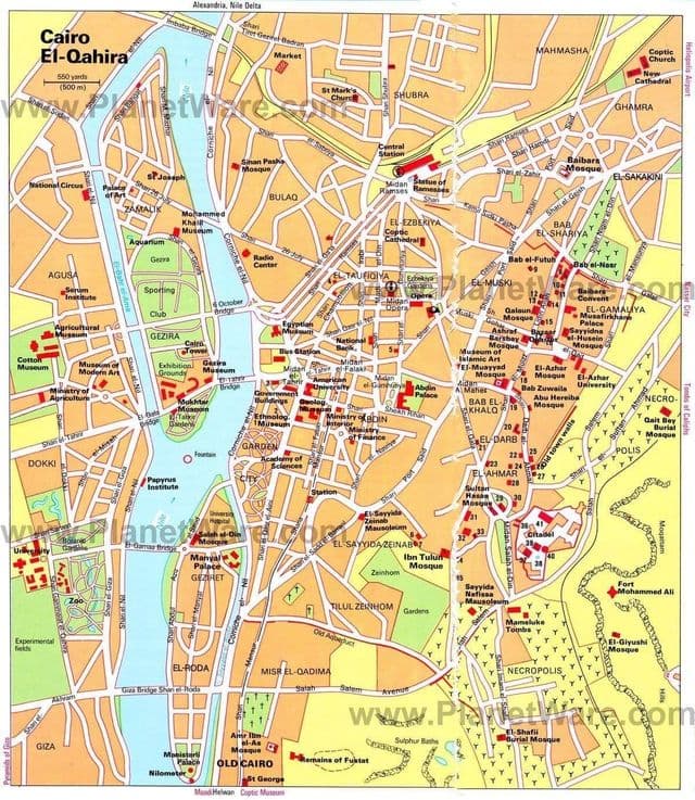
Cairo downtown map
The map of downtown Cairo shows the historical center of Cairo. This downtown map of Cairo will allow you to easily plan your visit in the center of Cairo in Egypt. The Cairo downtown map is downloadable in PDF, printable and free.
The central business district, referred to as the Wasṭ al-Balad (“city centre,” or downtown), is flanked by these older quarters. The Wasṭ al-Balad includes the older Al-Azbakiyyah district, Garden City, and, more recently, Jazīrah, the island offshore as you can see in Cairo downtown map. The major thoroughfare connecting the city along its north-south axis is the Kūrnīsh al-Nīl (the Corniche), a highway paralleling the Nile River, built in the 1950s. Along the Corniche lie the Television Building, the Ministry of Foreign Affairs, and a number of hotels; in addition, the Egyptian Museum is nearby. One of the most renowned downtown buildings, on the 29th of Hoda Shaarawy Street, is the cafe Riche, opened in 1908, the venue witnessed many historically significant events over the last century, it is said to be where the King Farouk saw his second wife , Nariman Sadek , where the perpetrator of the 1919 failed assassination attempt on prime minister Youssef Wahba Pacha lay in wait for his target, and where the basement, several members of the resistance during the 1919 revolution met to organize their activities and print their flyers.
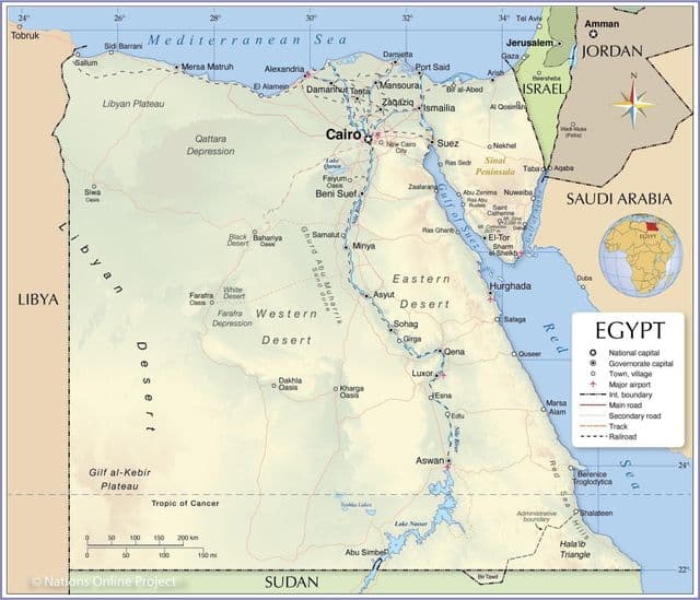
Cairo Egypt map
Cairo on Egypt map shows the location of the city of Cairo on the Egypt map. This map of Cairo in Egypt will allow you to easily plan your travel in Cairo in Egypt. Cairo on map of Egypt is downloadable in PDF, printable and free.
Cairo is also associated with Ancient Egypt due to its proximity to the ancient cities of Memphis, Giza and Fustat which are nearby to the Great Sphinx and the pyramids of Giza. Egyptians today often refer to Cairo as Maṣr (Arabic: مصر), the Arabic pronunciation of the name for Egypt itself, emphasizing the city’s continued role in Egyptian influence. With a population of 6.76 million spread over 453 square kilometers (175 sq mi), Cairo is by far the largest city in Egypt. With an additional ten million inhabitants just outside the city. Cairo is located in northern Egypt, known as Lower Egypt, 165 kilometres (100 mi) south of the Mediterranean Sea and 120 kilometres (75 mi) west of the Gulf of Suez and Suez Canal as you can see in Cairo Egypt map.
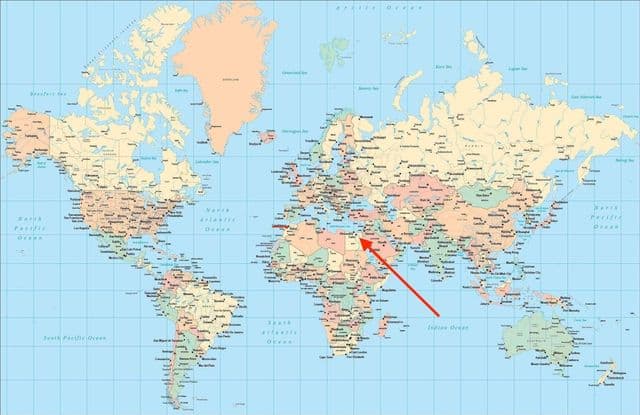
Cairo on world map
Cairo on world map shows the location of the city of Cairo in the world. Cairo on world map will allow you to easily know where is Cairo in the world. The Cairo in world map is downloadable in PDF, printable and free.
Cairo resides at the centre of the largest metropolitan area in Africa and the eleventh-largest urban area in the world. Cairo, like many other mega-cities, suffers from high levels of pollution and traffic, but its metro – one of only two metros on the African continent (the other one being the Algiers Metro) also ranks among the fifteen busiest in the world, with over 700 million passenger rides annually. Cairo is the largest city in the Arab world and Africa, and the 16th largest metropolitan area in the world as you can see in Cairo on world map.