Cairo tram map
You can find on this page the Cairo tram map to print and to download in PDF. The Cairo trams map presents the network, zones, stations and different lines of the tramway of Cairo in Egypt.
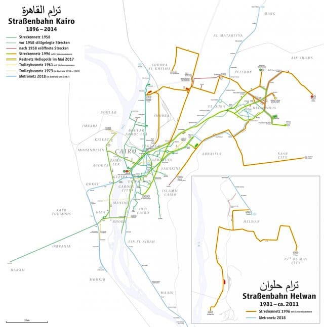
Cairo tramway map
The Cairo tram map shows all the stations and lines of the Cairo tramways. This tramway map of Cairo will allow you to easily plan your routes in the trams of Cairo in Egypt. The Cairo tram map is downloadable in PDF, printable and free.
Cairo tramway origins date back to 1894, by which time Egypt had fallen under British rule. Despite this, the infrastructure for the transport systems were largely in French and Arabic, with the former harking back to previous occupation by France and the fact that the original tramway was owned by a large Belgian tramway company. As the lines were extended and developed, a route was even laid through to the famous Pyramids at Giza but this was closed in 1957 as its mentioned in Cairo tramway map. The outlying town of Heliopolis was joined to the system in around 1908.